Friday, November 12, 2010

State High Point - Pennsylvania!

I've never really been a highpointer, but I do like heights!  So a fascination with highpointing may have been inevitable.  Without further ado, here's the first in my series of high point adventures!

Pennsylvania's Highest Point
Casselman Wind Project
On the way home from Pittsburgh in July, Jimmy and I decided that we should stop by PA's highest point, and since Ken was in the car with us, he came too.  Not long after we got off the turnpike and started taking some of Somerset County's winding roads, we saw some wind turbines in the distance.  We agreed that if we came anywhere near them we'd try to find a way to get closer to explore.  Fortunately, we ended up driving right past a service road for the Casselman Wind Power Project!  And so we had some fun taking photos and admiring the turbines.  :)  Most of them were spinning, but it seemed that they were powered to slightly spin even if there wasn't much wind.  I suppose it uses more energy to start them up again from a dead stop than it does to keep them a little powered all the time.  Anyway, here are my photos!


Wind Farm!
Casselman Wind Power Project - Iberdrola Renewables
Peking Around A Wind Mill Looking Up!
Shocking!
Majestic Wind Mill


Mt. Davis
Having had our fill of wind energy, we continued on towards Mt Davis.  The elevation change in our drive to the highpoint was very gradual, and we were almost surprised when we saw the "High Point" sign. We pulled over for the obligatory photos, and found a path going back into the woods to what turned out to be Baughman Rocks.We found a really nice deck with some benches, and on the other side of that, the actual rocks.  There is also a plaque that shares the creepy story of the family the rocks were named after.  And as seems to be the case in most rural areas, the high point sign seems to be a target for shooting practice.


Path to Baughman Rocks
Baughman Rocks Sign
Baughman Rocks plaque
Sitting Area at Baughman Rocks
Sitting area at Baughman Rocks
Baughman Rocks... Rocks!
The rocks!
Jimmy + Mt Davis Sign
Jimmy + Mt Davis sign
Mt Davis Sign.. Bang Bang
Bang bang


We continued a bit further, turned down what looked like an access road, and found a parking lot.  There were a bunch of hiking trails that we opted not to test, as it nearly 100°F, and we were melting.  We did climb to the top of the observation tower, and admired the large relief map and the beautiful surroundings.  The plaque at the top of the tower even went so far as to explain the optical illusion of other mountains looking higher than the highpoint, when viewed from the tower.  I was particularly fond of one tree that we saw towering over the rest of the scenery.


Mt Davis Lookout Tower
The Mt Davis lookout tower
Atop the Lookout Tower
Relief map and description
View from the Lookout Tower
Highest tree in PA?
Highest Tree in PA?
My favorite tree again!


According to the DCNR brochure:
    "Mt. Davis was named after John Nelson Davis, an early settler and former owner of the site.  He was a Civil War veteran, land surveyor, and naturalist.  It is said that he could readily identify all the wildlife and wild plants in the region, and was familiar with the various rock formations. 
    This area is unique in that the central feature is a rock, 3,213 feet above sea level.  This rock is the highest point in Pennsylvania. ..."
    Mt. Davis is beautiful, and I'd definitely like to visit again this spring and check out some of the hiking trails!

    Maps and Links
    All state high points can be found on a map here, and further information on state high and low points can be found listed here.  Of course I need my own map to track my visits, so here is my map of state high points.  I promise I'll keep it updated. :)

    View US High Points in a larger map

    For more information on Mt Davis:

    Thursday, November 4, 2010

    Abandoned Pennsylvania Turnpike

    Special thanks to Jane at Desolation Travel for posting a link to this article!
    Be sure to check out her awesome site!  Woo!

    In the summer of 2008 two friends and I rented a truck, threw our bicycles in the back, and drove about 3 hours west... to Breezewood, PA.  Breezewood itself is an interesting place, but it wasn't the purpose of our trip.  What was?  The 10+ miles of Pennsylvania Turnpike that had been abandoned 40 years earlier.

    I had come across a few websites about the Abandoned PA Turnpike earlier in the year, and immediately decided that I needed to visit.  I was completely fascinated by the idea of such a large abandoned segment of highway, now available for the daring hiker or bicyclist to explore.  That, and it was close enough to do in a day trip. 

    The Journey 

    Breezewood
    Upon taking exit 161 off of the PA Turnpike (I-76/I-70), we found ourselves in Breezewood, PA.  Having been a popular travel route since only a Native American trail passed through the valley, Breezewood caters to the traveler passing through. The main stretch (Lincoln Hwy/US-30) is absolutely PACKED with motels, fast food restaurants, quick-marts, gas stations with plenty of overnight truck parking, and a travel center with shops to pick up anything an interstate traveler may need (including a rogue Radio Shack, which produces receipts that other Radio Shacks won't recognize for exchanges).  And traffic.  Breezewood has lots of traffic.  And everyone is in a hurry to get back on the road.

    Breezewood 6
    A peek down Rt 30 (via flickr user Sean_Marshall)

    To say Breezewood caters to travelers is not to say that it is a very hospitable place.  In fact, most of the motels/restaurants/gas stations/etc are pretty run down looking, or quite outdated to say the very least.  Take for example, the Breezewood Motel:

    Breezewood Motel
    $29/night is a steal, but I can't say I'd want to sleep there.  
    The ladder on the right is a nice touch.

    Onward to the Abandoned Highway
    Eager to get to biking, we continued a few hundred feet east on US-30 and found what looked like as good a parking spot as any.  We found a car parked in a gravel area between US-30 and Tannery Rd, right at the base of a hill.  The hill was the bank for the overpass that had since been torn down, and at the top was our entrance to the Abandoned Turnpike!

    Bike2Pike Entrance
    "Pike2Bike is closed.  You can still use it, but it's your own fault if you die."

    Start of the Abandoned PA Turnpike
    Welcome to a former highway!

    After about 1.5 miles of old highway with the occasional ambitious plant growing in a large crack, we found what may be the abandoned highway's biggest draw: a tunnel.  This is the Ray's Hill Tunnel.  It's about 2/3 of a mile long.  When it was in use, it was the shortest of the Turnpike's seven tunnels.  And now here it stands.  Forty years after its closure, and becoming more and more overgrown by nature.

    Ray's Hill Tunnel + Matty
    My friend Matty in front of Ray's Hill Tunnel

    Looking into the tunnel, the only light was the tiny dot of sunlight we could see at the other end.  The air was cool and moist, and smelled of mold.  I took a photo using a flash, and quickly saw that the air looked as unpleasant as it smelled.

    Ray's Hill Tunnel
    Delicious.

    We found a rusty chair near the tunnel entrance, and the requisite amount of graffiti, but not much else.  As for the doors to the left, locked.  Since we had to pass through this tunnel again to get back to the car, we decided to try our luck with the doors on the next tunnel and save breaking and entering for later in the trip if necessary.  We still had a lot more of the highway to explore!

    Exiting Ray's Hill Tunnel  |  Chernobyl?  Nope!
    Exiting Ray's Hill Tunnel                      |             Photo from Chernobyl?  Nope!

    And so we biked onward.  The highway segment between the two tunnels isn't very different from a typical limited-access highway.  Sure the road condition is a bit sub-par, and in places it's overgrown with plants, but it otherwise feels pretty much like a ride on a highway in rural PA - complete with occasional glimpses of farms.  The highway has been used off and on for testing... testing new fuels, testing new paint, testing new reflectors, testing rumble-strips.  So we encountered a bunch of changes in the road as we biked along.   

    Approaching Sideling Hill Tunnel    Reflector

    Next up is the Sideling Hill Tunnel.  At around 1.3 miles long, it is the longest tunnel on the PA Turnpike.  The door to the room next to the tunnel entrance had been torn off, so we poked around with flashlights.  The floor was flooded with about an inch of standing rusty water, but past that we found the stairs leading up to the ventilation shafts.  Awesome!!  Several stairs were missing, and many more were completely rusted through.  Maybe this was a bad idea?  No going back.  Upon reaching the next floor, I noticed something was missing... a bunch of the floor.  Not sure why or how, as it's a concrete structure.  We managed to not plummet to our collective death.  The next room housed a bunch of old equipment, which is apparently now a popular restroom for birds.  Past the rusty equipment is an attic area that seemed to span the length of the tunnel.  With lots of little circular holes in the floor, I'm guessing it was also used as access to change light bulbs in the tunnel ceiling.  There was another room off to the side, but my friend entered and quickly exited, notifying us that there was a rotting vulture just inside the room, and not much else.  Pass.  Back around the missing-floor, down the rusty stairs, through the flooded room, and outside we go. 

    First Floor of Sideling Hill Tunnel  |  3rd Floor of Sideling Hill Tunnel - Gears 
     First floor sludge                     |                     Poopy equipment

    3rd Floor of Sideling Hill Tunnel - Ventilation/Access Shaft
     Ventilation attic with light bulb access

    Since our flashlights had already endured one tunnel and a bunch of building exploration, the batteries were pretty drained.  We made it maybe 1/5 of the way into the Sideling Hill Tunnel when our lights went out.  We could still see the end of the tunnel we came from, but only darkness the direction we were heading.  So we decided turning back was a better option than continuing into complete darkness with concrete falling from above us and holes in the road.  Back to Breezewood for lunch, and a little driving around to charge the flashlights.  We drove over to the other side of the Sideling Hill Tunnel, and attempted it from the opposite direction.  Some cool road signs, graffiti, and a surplus of concrete medians were there. As the flashlights didn't hold up for more than a few minutes, we had to leave the tunnel uncompleted.

    The History

    Why was the turnpike abandoned?
    All seven tunnels on the PA Turnpike were originally single tunnels through the mountain.  The highway is two lanes in each direction, but at each tunnel it would squeeze down to one lane in each direction.  An increase in vehicular traffic meant that there were frequent bottleneck issues.  So in the 1960s the four tunnels that are still in operation were "twinned", meaning an additional tunnel was added right next to the existing one, to provide two lanes in each direction.  The other three tunnels were bypassed, as I assume they thought it would be easier to go over and around the mountains, rather than through them again.  The current rumor on the internet is that the third bypassed tunnel (Laurel Hill) is being used as a shed for road salt by the Turnpike Commission.  So it's off limits.

    Maps and Sources

    I've created a map that may help if you ever visit:

    View Abandoned PA Turnpike in a larger map

    Sources:

    Wednesday, October 27, 2010

    No Turbot in Turbotville, PA

    While en route from Bethlehem, PA to Williamsport, PA, I passed signs on I-180 for a place called Turbotville.  I was amused by the name, but didn't think much beyond that.


    Last night, while looking at a website about Iqaluit (yes, I'm still obsessed with Nunavut's capital), I read something about a "turbot fishing industry".  What?!  Turbot is a word outside of the tiny borough in Pennsylvania?!

    Interwebz to the rescue!  Turbot are a type of fish!  More specifically, a flatfish.  They're related to flounder and halibut!  I assume they're similarly delicious.

    http://upload.wikimedia.org/wikipedia/commons/thumb/8/84/Psetta_maxima_Luc_Viatour.jpg/800px-Psetta_maxima_Luc_Viatour.jpg
     My, why lovely eyes you have!

    Despite how cool this fish looks, Turbotville is not named after it.  In fact, it appears that the fish lives nowhere near Turbotville, PA.  It lives in the North Atlantic (hence, Iqaluit), the Mediterranean, the Baltic Sea, and the Black Sea.

    So then what was Turbotville named after?!  Wikipedia has this to say:
      "The original name was Snydertown, but the name was later changed for Turbot Township (originally Turbutt). The borough now lies completely inside Lewis Township. The first settlement was made by Philip Reifsnyder, a blacksmith, who built a house near the corner of Main and Paradise streets."  
    So the borough was named for the township it used to be part of, but I can't find anything about the origin of the township's name.  It was probably the name of one of the early settlers in the area.

    Also, Turbotville has their own bank: Turbotville National Bank!

    Friday, October 15, 2010

    Subdivisions of Hungary

    Hungary has been in the news a lot lately, but that's not why I'm blogging about it.  I recently came across a blog which asked about subdivisions of Hungary.  I'm not sure if this will answer those questions, but I hope it helps...  As a disclaimer, most of what I know about Hungary is from the era of the Austrian-Hungarian Empire... so I'm modernizing a bit here :-P

    Anyhoo, Hungary has 19 counties and the capital (Budapest), and is divided into seven regions, as seen on the map below.  I included the Danube and Tisza rivers, as they were the dividers on the original map in question.


    Ok, you caught me.  I was looking for an excuse to make maps of central Europe. :)

    Data source: DIVA-GIS

    Friday, October 8, 2010

    Red Canyon

    Looking through photos from a friend's recent trip to Utah and Colorado reminded me of my visit to Utah, in which I visited Zion National Park and Bryce Canyon (and Antelope Canyon near Page, AZ, but that's for another article).

    Driving from Zion to Bryce is a nice trip. There are some small towns and some nice Utah scenery on UT-9 and US-89. At first it appears as though you'll see more of the same scenery on UT-12. Then, all of a sudden, you are greeted by the lovely red sandstone Red Canyon!
    Surprise!

    View Larger Map

    You even get to drive through an arch! Awesome!!

    View Larger Map

    Red Canyon is part of Dixie National Forest. There are other canyons in Utah with the same name, so don't be fooled! Although, the others are probably awesome too, and I hear there is a slot canyon involved!

    Using data from Utah's GIS Portal, I threw together this map of the area. It should help give you an overview of the area, and it was a good excuse for me to play with Utah's data. :)


    Seeing as you drive through the area on the way from Zion to Bryce, it seems that most travelers simply drive through without stopping. But it's beautiful there! So give it a visit! There are lots of trails, hoodoos, awesome scenery, and a visitor center. Though the visitor center was closed when I stopped, I enjoyed my visit and went for a short hike on a roadside trail.

    And here's a photo I took:
    Red Cayon

    Saturday, August 28, 2010

    Jersey Shore, PA

    On a recent road trip for work I drove past signs for Jersey Shore, PA.  It's a town of 4000-5000 people, about mid-way between the cities of Williamsport and Lock Haven.


    View Larger Map

    I didn't actually pass through the town, but I was curious how it got its name. Some quick Wikipedia research provided this:
      Jersey Shore was originally named Waynesburg by the two brothers, Reuben and Jeremiah Manning, who laid out the town circa 1785. Around the time that this was happening, a settlement arose on the eastern side of the West Branch Susquehanna River (Nippenose Township), opposite Waynesburg. A rivalry developed between the two settlements, and those on the eastern shore began referring to the settlement on the western shore as the "Jersey Shore," because the Manning family had relocated from New Jersey. The nickname became so fixed that in 1826 the original name of Waynesburg was officially abandoned and changed to Jersey Shore.
    So the town was named after an insult to its founder. Spiffy!

    Jersey Shore old houses
    Not New Jersey.

    Wednesday, August 4, 2010

    A Cool Canadian Capital City - Iqaluit

    I'm very fascinated by remote and 'extreme' locations.  It intrigues me to consider what daily life is like in a place so vastly different than any place I've lived.  I'm from Pennsylvania.  To me, PA is pretty "normal".  There aren't many extremes (no extreme hot or cold, no extreme light or darkness).  It's a pretty reasonable place to live, with four separate seasons and a variety of weather. It's also got a good mix of densely populated areas and sparsely populated areas.  Pretty normal, not too extreme.  So let's talk about a more extreme locale...

    Nunavut!
    In 1999, Nunavut packed it's bags (not literally) and quit being part of Canada's Northwest Territories to become a territory of its own.  Nunavut spans nearly 1,932,255 sq kilometers of land, and around 20% of its nearly 30,000 people live in its capital, Iqaluit. To put that into perspective, if each member of Nunavut's population had 1sq km of land all to themselves, they'd fit entirely on Prince of Wales Island.  With land left over.  Also, Prince of Wales Island is just slightly smaller than Taiwan, and Taiwan is home to over 2.6 million people.  Hmm. 

    Here's a map of Prince of Wales Island, so you can compare it to the rest of Nunavut.

    View Nunavut and Prince of Wales Island in a larger map

    So if everyone in Nunavut went to a party on Prince of Wales Island and ended up wanting to stay there (nevermind that it's uninhabited), Nunavut would still have more land than ALASKA available for the polar bears and muskoxen and birds and other cool stuff.  Just THINK about that!

    Anyway, I think the population density alone is a huge factor for life being vastly different up there.  You know, that and snow.  And polar bears.  And muskoxen. 

    MUSKOXEN!?!
    Did you know they're related to sheep?  Baaaaa.

    Speaking of Nunavut's cool critters... Their license plates rock!  They kept the same license plates when they separated from the Northwest Territories.  Which means that their license plates are shaped like POLAR BEARS!!  Here is a way cool sample, courtesy of Wikipedia and Flickr:
    Roar!

    Ok, enough about Nunavut.  It's time for Iqaluit! 

    Iqaluit!
    Iqaluit is Nunavut's capital city, and it is home to somewhere around 6,000 people.  Your college may have had more people than that.  Mine didn't.

    While English and French are the official languages in Iqaluit (and Canada in general), about half of the population in Iqaluit predominantly speaks a non-official language, such as Inuinnaqtun and Inuktitut, which are among the Inuit languages.  According to the wiki article, Iqaluit means "place of many fish" in Inukitut.  Here is a stop sign in Iqaluit!
    Don't you wish your alphabet was that cool?
    The 4-way stop diagram rules too!

    Iqaluit was also featured in a White Stripes video!


    Let's Visit!
    Now that you know some of the reasons I'm fascinated by Iqaluit and its bright yellow airport, let's visit!  You can fly there from Montreal and Ottawa!  The Nunavut Tourism website has lots of suggestions on awesome things to do there.  For example, we can go on a number of Arctic Odysseys!


    Stats & Data from Statistics Canada.  :)

    Thursday, July 29, 2010

    Coconut Lime Tofu!

    Sounds DELICIOUS, doesn't it?!

    I don't claim to be a good cook, or anything of the sort, but a few months ago I made salmon with an orange ginger glaze.  Not surprisingly, it was amazing. :)

    Salmon is great and everything, but Jimmy and I really like tofu.  So we took that recipe and turned it into coconut lime tofu!

    Here's the deal:
    • Boil 1 cup of limeade with some chopped up ginger root.  (The orange juice from the original recipe reduced to about 1/2, but the limeade won't reduce quite that much.)  I think we threw in some garlic too.  
    • Cut up a package of firm tofu into cubes, and place in one of those spiffy oven safe glass pans.
      +
    yay tofu and limeade! 
    • After the limeade and ginger look sufficiently boiled, pour it over the tofu cubes in the pan.
    • Sprinkle some shredded coconut on top!
    • Bake it for a while... Original recipe says 400°F for 15ish minutes.  When the coconut on top looks crispy, I think it's done! 
    Serve it over some rice!


    Aaaand that's it!  Go make me some coconut lime (ginger) tofu! :)

    Thursday, May 20, 2010

    A Brief Comparison of Eastern European Languages

    My genealogical research involved the Rusyn people in Eastern Europe. While they have their own language, so does everybody else in that neighborhood! This means that looking at old maps and church documents becomes a crash course in learning a few key words in multiple languages. You quickly begin to see how place names evolved over time, depending on the ruling country of the day. I was curious to compare several of the languages that exist in Rusyn areas. Since place names aren't exactly universal, it makes comparing languages pretty sticky. Since churches are quite vital to genealogical research [they held the records!], I decided to compare the word "church".

    Disclaimer time! I don't speak these languages... so Google Translate is my source. So all credit/blame goes to them. :)

    Here is a comparison of "church" in Rusyn to "church" in a variety of other languages from nearby countries. Transliteration of words in Cyrillic are in parentheses after each word.
    Rusyn
    цирков (cyrkov)
    Bulgarian
    църква (tsŭrkva)
    Croatian
    crkva
    Czech
    kostel
    Estonian
    kirik
    Finnish
    kirkko
    Galician
    igrexa
    Hungarian
    templom
    Latvian
    baznīca
    Lithuanian
    bažnyčia
    Norwegian
    kirke
    Polish
    kościół
    Romanian
    biserică
    Russian
    церковь (tserkov')
    Serbian
    црква (crkva)
    Slovak
    kostol
    Slovenian
    cerkev
    Swedish
    kyrka
    Ukrainian
    церква (tserkva)

    I was very surprised to see how different the Czech and Slovak words are from Rusyn, especially when considering their proximity to the Rusyn area [Rusyns live in Slovakia and Ukraine] and the fact that a lot of Rusyn words are very similar to their counterparts in Czech/Slovak. No surprise here: the Rusyn word is very similar to Russian and Ukrainian.

    I ended up including the Baltic States because of how similar some of their words are to the Romanian word for church. Unexpected!

    As always, Hungary is an outlier. :-P

    I'm sure you're wondering why I included Galician, as it clearly has nothing to do with anything I'm talking about. I included it simply to point out that the Galician language in Google Translate refers to Galicia in Spain, not Galicia the historic area in Eastern Europe.

    To help visualize these variations, I threw together a map:

    Fascinating, no?!

    Monday, May 17, 2010

    Tea Time: Aloe Vera with Cactus

    On a recent trip to a corner grocery store in CA I purchased some generic anise tea (mmmmmmm) as well as Tadin's Aloe Vera with Cactus Tea. Cacti are cool, and I had prickly pear tea once, so I was excited about this purchase!

    dun-dun-DUN!!!


    It tasted like chemicals! I had made it in a styrofoam cup [silly hotels], so I assumed that was the problem. Wrong-o. I made the tea in a real mug upon my return home, and it was just as bad.

    If only I had seen this review before purchasing the stuff! Tea Amigos gave it an F and an F+. Yikes!

    Steer clear of this one!

    If you want to try it for yourself, let me know! I'll share!

    Tuesday, April 13, 2010

    Guest Blogging!

    My friend Bindesh over at DesiGrub.com has allowed me to be a guest blogger! The article documents the adventure Jimmy and I had with making seitan sausage last year. Good times! So check it out, and enjoy the rest of his blog as well!

    Seitan Sausage

    Wednesday, February 17, 2010

    Google Maps and Ukraine

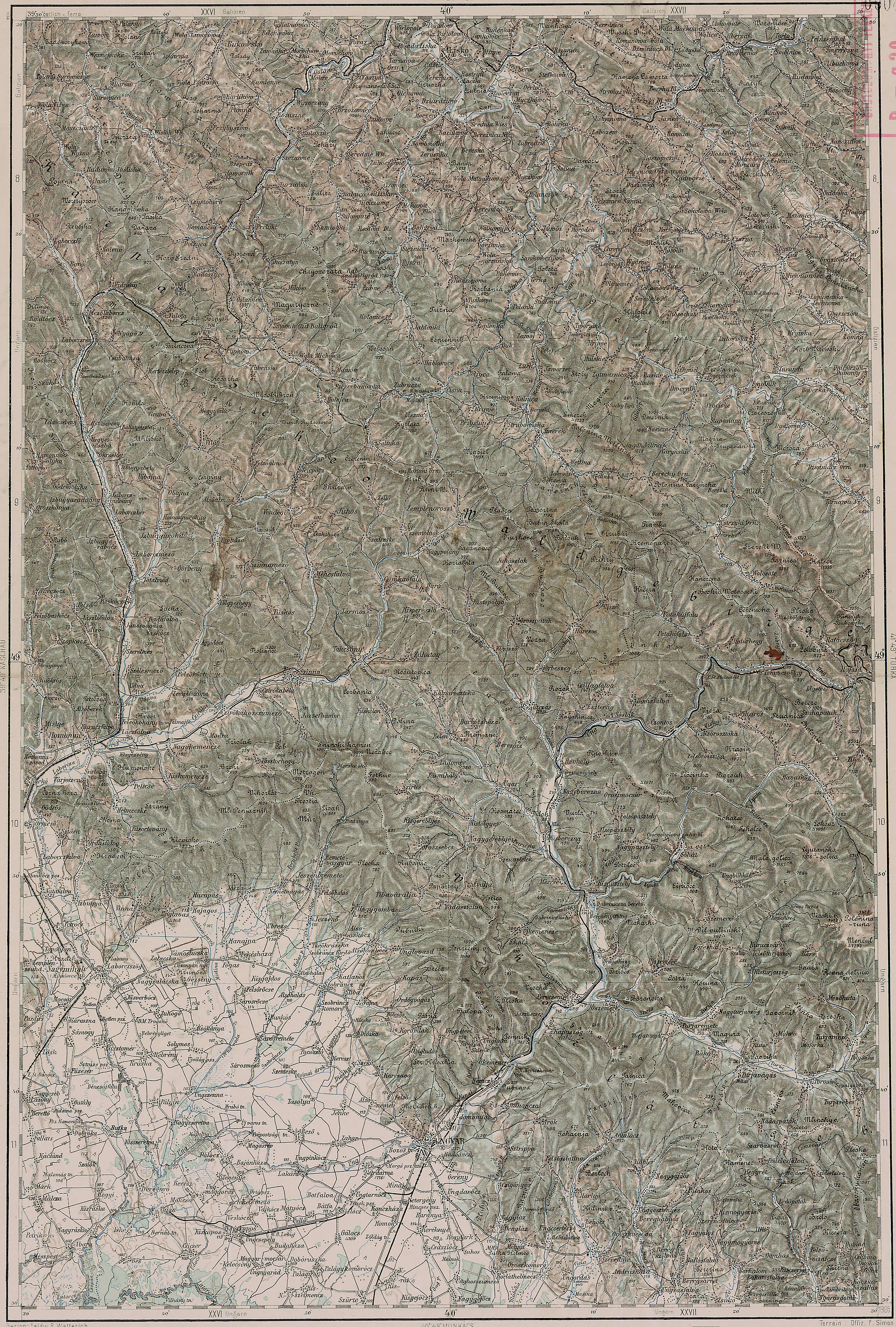
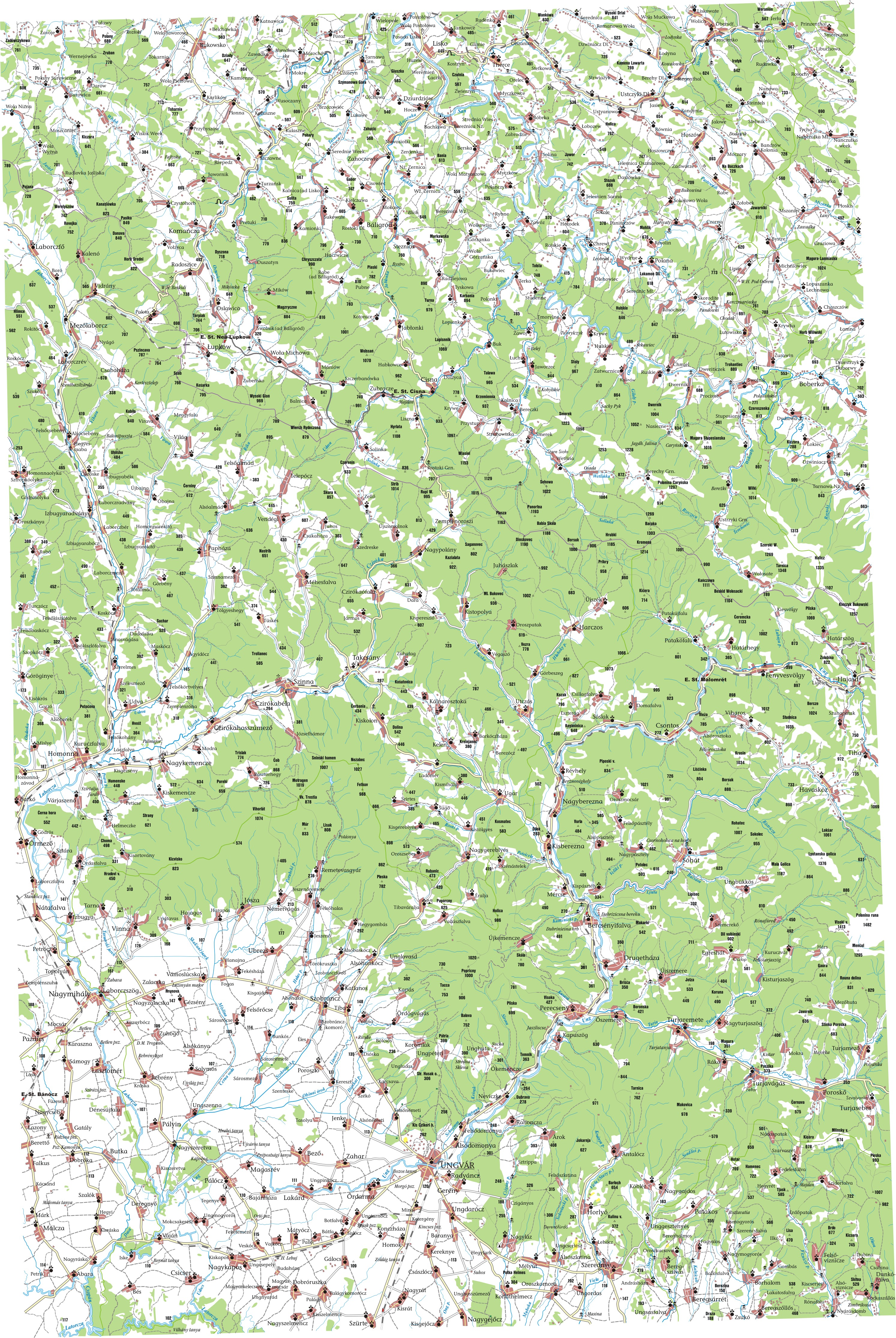
    About five years ago I started researching my family's genealogy, and I found myself searching for information on remote villages in Eastern Europe. There was a lot of information to be found on villages in the Slovak Republic, Poland, Slovenia, etc, but Ukraine remained mysterious. There was virtually no Ukraine data in Google Maps, and Yahoo! Maps provided only major roads and cities. After the easy route turned out to be a dead end, I began looking at historic maps from the Austro-Hungarian Empire. Some of these maps provided great information about the geography of the area I was researching, and some had been redrawn to provide a better look at populated places.


    Five years later, it looks like Google is finally adding Ukraine data!  Take a look at Uzhgorod, the capital of Zakarpats'ka Oblast! Such detail!


    View Larger Map


    I noticed today that hi-res satellite imagery is inching up on Ljuta, which was a village of particular interest to me.


    View Larger Map


    For some extra eyestrain, try to find Ljuta on the maps I linked to in the first paragraph [or anywhere else in the Austro-Hungarian Empire]! In Hungarian, Ljuta is called Havasköz.

    Wednesday, January 27, 2010

    Fruita, CO Has Caught My Eye!

    After a recent trip to Denver, I spent some time reading about types of municipalities in Colorado, during which I came across a home rule municipality in western Colorado named Fruita. 

    Located near the CO/UT border, Fruita is about 20 minutes outside of Grand Junction.  For a fairly small municipality, it seems like a place with a lot of character!  First things first, there is a museum called Dinosaur Journey. While I think I'd be hardpressed to find a dinosaur museum that didn't interest me, this one offers a variety of DINO DIGS! Anyone want to dig up some dinosaur bones with me?!

    Aside from dinosaurs, Fruita is also known as a hotbed for technical mountain bike trails. If you are a fairly hardcore mountain biker, you may want to check out Back Country Biker for some potential vacation ideas. :)  Mountain Bike Fruita has more information on specific trails and their difficulty.

    One of the things I found most interesting about Fruita is their GIS website. It's pretty fantastic! They've got a variety of maps available from parks to zoning to utilities. So... check it out!

    Oh yeah, and they have an annual festival dedicated to Mike the Headless Chicken. I kid you not.

    In closing, here's a song about being a paleontologist. :)

    Friday, November 20, 2009

    Bethlehems!

    Today a friend inquired about where the city of Bethlehem ends and Bethlehem Township begins. Naturally, I went to census.gov, found an applicable shapefile, and pulled out the information I needed. Census.gov has some pretty great data, such as the shapefile I used for this, which was a breakdown of every municipality in the state. Woo!

    So, here's the map:

    View The Bethlehems of Pennsylvania in a larger map


    Also note that the city is spread across two counties, so it gets two entries here.

    And another thing, I'm doing this on my phone, so if it doesn't work, give me a few hours and I'll fix it tonight. :)

    Wednesday, August 26, 2009

    Lehigh Valley Bike Trails!

    Remember June of last year, when I posted a map I made of bike trails in the Lehigh Valley? Well, I finally got around to mapping bike trails at Jacobsburg Park, Lake Nockamixon and Lock Ridge Park!

    Updated Map!

    View Bike Trails [Lehigh Valley] in a larger map

    I based the trails at Nockamixon and Lock Ridge off of my GPS tracks from recent rides there. My GPS isn't the most accurate device ever, but it does a decent job, especially considering its price tag.

    Anyone know of any cool trails in the LV that I'm missing?

    Monday, July 27, 2009

    Natural Gas Usage in the United States

    My most recent mapping endeavor stems from my curiosity over which states consume the most natural gas. After searching for a map presenting this information to no avail, I decided that I'd put something together.

    The Energy Information Administration had all of the information I needed, broken down by end use, State, Month/Year, etc. I am mainly interested in 2008 data about Residential, Commercial, and Industrial usage, so I didn't make a map for Vehicle Fuel or Electric Power usage, although that data is available as well.

    I present to you my results:
    Drumroll, please!


    A few notes:
    After you load these files in Google Earth, you can drill down to the state polygons in the Places panel. When you double-click a polygon, it will zoom to that state and display a bubble with usage information and rank.

    All natural gas quantities are measured in MMcf.

    For quick/simple viewing, use the web version!

    Tuesday, March 17, 2009

    Tea Time: Blueberry Lemon Black Tea

    I drink way too much tea to not have a recurring category about it in this blog. I have creatively decided to name it "Tea Time".
    [Why don't I get paid to blog, again??]

    The tea aisle in The Weg is quite a magnificent place. They have a great selection of prepackaged and loose tea, and if you get there early enough, they even have some samples!

    One day, while lost in said aisle, I came across their selection of Eastern Shore Teas. After much deliberation, I opted for black tea with blueberry and lemon. It is AMAZING. Usually blueberry teas are too blueberry-ful for me, but the lemon in here balances it out nicely.


    I've tried various other Eastern Shore Teas, and they've all been good, but this one ranks among my favorite teas ever. Though sometimes hard to find, it's definitely worth the wait. And if there isn't a Wegmans near you, then maybe you should just buy it online?

    Monday, January 26, 2009

    US Airport Map

    To say I like to travel is a pretty big understatement. I seem to spend all of my non-travel time thinking about where I'll go next. Sometimes my trips are off the beaten path or in the middle of nowhere, so it can be a challenge to figure out the nearest airports for some ticket comparison shopping. No longer! My latest creation is a map of all US airports with commercial service! I know what you're thinking, "Christine, why don't you do useful things with your time?!" I actually think a lot of people will find this useful; at least hopefully.


    View Larger Map

    Directions
    For those not too familiar with Google Maps, I think the following is a good way of using this overlay.
    • Log in to Google

    • Go to the map

    • Click "Save to My Maps" in the upper right corner of the Left-hand panel

    • Click the checkbox next to "Airports - US"

    • Search for your destination

    • Zoom out to see the nearest airports

    Hopefully that'll work for everyone. If you don't have a Google account... well, you should get one, because Gmail rocks.
    If you have any comments, suggestions, corrections, etc, leave me a comment!
    Enjoy and happy travels!

    Tuesday, January 20, 2009

    The Case of the iPod

    If you've ever met me you probably know that I love my iPod. I know, I know, it's an annoying trend and there are better devices out there, whatever. I bought the iPod because it syncs easily with iTunes (I hate the Windows version, but it's better than most alternatives) and because of the storage capacity. At 160GB I can carry my entire music library with me at all times.

    If you've ever met me you probably also know that, while I'm not a total disaster, I'm pretty hard on my stuff. My electronic devices get used hard, and this sometimes means accidentally dropping things like my cell phone, iPod, external hard drive, etc.

    The Dilemma: iPods are kind of fragile. I have a 160GB Classic, so it's an actual hard drive, not a solid state.

    The Solution: the ArmorSkin Case by Speck!


    The Test: I accidentally dropped my iPod down a flight of steel stairs. While I wouldn't try this test often, my iPod still works and there's only a small scrape in the side bevel of the case's front cover. Yay!

    The case is available in black or clear and is nice and grippy so your iPod doesn't slide out of your hands or pocket and onto the concrete or into a lake. :-P

    Before I got this case, I kept my iPod in a sock. Not an actual "iPod sock" but a sock from my sock drawer. This is definitely a much better case!

    Also, Speck has a cool logo and their slogan is punny.

    Tuesday, December 2, 2008

    Снова в СССР / Back in the USSR

    Last Saturday night I decided it was time again for a trip to Tunes in Hoboken. I love Tunes because they have a pretty big selection of $1 CDs, and I think you know by now that I'm addicted to music. Anyway, after sitting in traffic forever and paying way too much money to a bunch of jerks* to park in their shady lot, we got to Tunes... about 30 minutes before it closed.

    After finding a bunch of CDs I wanted I decided to look through the vinyl section, as I recently acquired a record player**. Of course I looked for some cool Beatles stuff, but then I looked under Paul McCartney. Then I saw it. The Russian album. Снова в СССР. Was this the 1994 international re-release? Nope, this was the original 1988 LP only available in Russia. The album jacket? All in Russian. SO AWESOME!

    Paul McCartney - The Russian Album

    Some Background Info
    In 1988 Paul McCartney released this collection of old school rock & roll covers with the intention of it only being available in the former USSR, since for so long the Beatles' music had been banned there. In 1991 it was re-released internationally because apparently everyone outside of Russia wanted to hear it too. In 1994 it was released on CD.

    By the way, "Снова в СССР" translates to "Back in the USSR".
    The cover art was done by Linda McCartney.
    On the international re-release they spelled it wrong (СНОВА Б СССР) and used some Cyrillic letters that look like Latin letters to spell Paul's name. Evidence:
    Image:CHOBA B CCCP album cover.jpg

    A Few Personal Notes
    I loved this CD as a kid, and remember listening to it on the way to a family vacation in Ocean City, MD.

    My aunt's cousin was living in Russia in the early '90s and was nice enough to bring back a copy of the original LP for my dad. I'm not sure where that copy got to, but I'm pretty psyched to have my own original copy now. And for only $8!

    "Crackin' Up" was my favorite song on the album, and you should go listen to it on last.fm. :)

    Footnotes
    *The jerks at the parking place in Hoboken earned $0 in tip money because the one guy almost ran my friends over with my car. Way to go, winner!

    **As for my record player... it doesn't work. Apparently the motor in this one is on the fritz too. Great. I'm going to go steal my dad's now. :)

    Friday, October 31, 2008

    Quakake!

    Another installment of "What? This is really a town name?!", Pennsylvania.

    To begin, I've never been to Quakake. I've driven very nearby, but never stopped. Honestly, until writing this blog I wasn't even quite sure how to pronounce it. Quay-Cake? Quake-ache? Qua-ka-kay? So many fun possibilities! I think it's really Quake-ache.

    Despite me having no idea how to pronounce it until today, this word has existed much earlier than today! It appears in the names of several things in northeastern[ish] PA. What kind of things, you ask?
    • A Town
    • A Railroad
    • A Creek
    • A Lake
    • Probably other things Google isn't telling me about

    Really? Tell me more!
    Ok.

    Quakake, The Town
    Quakake is in the northeastern part of Schuylkill County. Its status of U6 tells me that it's pretty much in the middle of nowhere. A quick look at a map proves my theory!

    View Larger Map
    Sure, it's 12 minutes from Hazleton, but... it's Hazleton.

    A look at that map will also reveal a pretty cool looking rail system! Which brings me to...

    Quakake, The Railroad
    Well, it used to be the Quakake Railroad. Then they went bankrupt and became the Lehigh & Mahanoy Railroad. According to the Wikipedia article, the tracks have been abandoned for several decades, but since they're still on the maps I wonder if they're still there? Maybe I'll find out one day.

    Quakake, The Creek
    It's a creek, and eventually meets up with the Lehigh (from the west). Not much else to tell you here...

    Quakeake, The Lake
    Yeah. It's called Quakake Lake. :) It's pretty funny looking too!
    It's about 20 minutes from Quakake, PA.

    What does it mean?
    The coolest book ever tells me the following:
      A corruption of Cuwenkeek, "pine lands". Cuwen-hanna would signify, "pine stream".
    PA Quakake Valley from Point Lookout 1896 by libraryimages.net.

    So there you have it, kids - Quakake.

    Monday, September 29, 2008

    Kim's Kitchen

    Since I like to eat and I can't seem to decide what to write about lately, I have decided to do some restaurant reviews! Fantastic, right?!

    Last Thursday night I was in the area, so I figured I'd stop by:
    Kim's Kitchen
    5842 Main St (Rt 309)
    Center Valley, PA
    [map]
    [One source told me this was Coopersburg, but it's really Center Valley.]

    Oh, and I first heard of this restaurant via Beyond Scrapple.

    I stopped in and asked what kind of Korean food she had on the menu. I was pleasantly greeted with several options and samples! My samples included:
    • bean sprout soup (verdict: TASTY!)

    • homemade dumplings [the sauce was great, and I normally don't even like dumplings!]

    • some fresh honeydew melon and strawberries

    • a cookie!

    I ordered a wrap version of bulgogi (marinated beef and onions), brown rice, kimchi, and she threw in some kind of scallions. All of it was delicious! There are various non-Korean options available for the less adventurous, but I'll definitely be returning to try her other Korean dishes. She also does catering for events and such.

    Also, aside from the awesome homemade food, you can't beat the service: helpful and friendly!

    And here is the cover of the Korean menu.

    Doesn't it make you hungry?!

    Tuesday, September 9, 2008

    Yellow Submarine

    I want this. It is now your civic duty to purchase it for me. :)

    Wednesday, September 3, 2008

    Twiggy Tea?

    Back in May I went to Vermont to visit some friends. Kate & Chris were awesome hosts, providing an excellent weekend of fun which included a picnic on North Beach / Lake Champlain, a stop at Cabot Creamery to sample cheese, an epic drive up Burke Mountain and hiking around the peak, tasting the brews at several Vermont breweries, a few stops at yummy places to eat in Burlington, and other awesome things. One such stop was at a place called Radio Bean.

    Radio Bean seemed like a great place, mostly because they had [free] live music on a Sunday night! Then we ordered beverages and things got disastrous. Chris ended up with some kind of burnt/smoked/gross coffee* and I opted to try Kukicha Twig Tea.

    According to Wikipedia, Kukicha is pretty amazing. They throw around phrases like "uniquely flavorful", "mildly nutty, and slightly creamy sweet flavor", and "rich in natural tannins". I find this intriguing because the tea I had that evening tasted like tree bark. Nutty? No. Creamy and sweet? No, and no. Imagine a log that has been in a campfire for an hour or so, steep that in some mouth-meltingly-hot water for a few minutes, and VOILA! You have tea!

    I understand that steeping tea for too long, or even at too high temperatures, can turn the tea bitter, but this was a bit ridiculous. Perhaps at some point in my life I'll get up the nerve to try this again... Otherwise, Radio Bean seemed like a cool place.
    Inside Radio Bean

    *According to some, this type of coffee is quite common in Vermont.

    Thursday, August 28, 2008

    2.5 Song Commute

    First off, no one commented on my last post requesting info on cool stuff to do in FL, so I'm now forced to follow through with my threat: maps. Lots of maps. They're coming. Beware.

    [Drastic subject change]

    I woke up this morning to a beautiful day.


    View from my bedroom window.

    Usually I opt for something energetic to wake me up and get me psyched, but today I opted for some relaxing music for my 10 minute commute to work with the windows down. 2.5 songs is probably a more accurate measurement than 10 minutes.

    My first song of choice for my 2.5 song commute? "Some Things About Me" by Steve Poltz. Since he's awesome, you can download it here. I first heard this song at a show at the World Cafe back in March. Good times, fun show, I love this song.

    My next song in my 2.5 song commute was "Impala", also by Steve Poltz. This song is pretty cool, and I particularly like the lines:
      Everything today is so high tech
      Why can't we just park by the lake and neck
    I don't remember what the .5 song was, but who cares. I had a great commute today. :)

    Monday, August 18, 2008

    Miami / Fort Lauderdale

    Greetings to my hundreds of readers! [I've counted each of you at least 75 times.]

    In a few months I will be going on a family vacation [what, seriously?] to Fort Lauderdale, FL. Of course, Miami is a much less... old... location, so I'll be spending some time there as well.

    I'm planning on doing some fun biking in parks and along waterways, potentially a day trip to the Everglades, and possibly visiting Key Biscayne because it looks pretty. Having never been to Florida, I ask:
    Where is the fun stuff?
    What are some must-see sights?
    Which are the best restaurants for a cheapo who wants good food?

    If you don't give me some good info I'll post more maps! Ha! I know, it's all part of my evil scheme.

    Friday, August 15, 2008

    More Local Map Excitement

    I'm sure you're all thrilled that, yet again, I'll be blogging about some random maps and local stuff I find interesting. Heh. Sure. Anyway, I was going to blog about some really good tea I recently purchased, but I don't have the photo with me at the moment, so I'm going to blog about that later. Stay tuned! For now: local geographic features!

    If you Google something about movie tickets and your zip code the first couple of sites listed are probably hello[yourtown].com. Judging based on the mass-produced [not to mention shady looking] URL, I've always refrained from clicking on these links. What could a site called hellobethlehem.com contain that I could possibly care about? Oddly enough, today I stumbled across some cool map mashups on that site. Who knew there would be something interesting on a site called hellobethlehem.com?! WHO KNEW?! I think this slightly interesting find is much more interesting when considering the source!

    Onward.
    Here are my favorite mashups they have:
    Lehigh Valley Islands
    Lehigh Valley Dams
    Lehigh Valley Lakes
    Lehigh Valley Gaps
    I realize a lot of the points on these maps are outside of the Lehigh Valley, but what are you going to do? I'm a bit surprised/impressed that they show the names of some of those random islands in the Lehigh River!

    In closing, hellobethlehem.com is apparently not the virus-laden website-o-death I assumed it to be. And yet I wouldn't be surprised if tomorrow the site fulfilled it's spammy destiny.

    Friday, July 18, 2008

    Ward Maps [Allentown and Bethlehem]

    One of my job functions requires me to know which ward of a city an address falls within. After obtaining a few paper maps I decided that there might be some random other person in the universe looking for a ward map for Allentown, PA... so I mapped it all out in Google Maps! Now I can easily search for an address, load my custom map overlay, and find the ward. :) While this originated because of my job, it very quickly became more hobby-related than work-related. :-P


    View Larger Map

    Notice the odd shape of Ward 17! Crazy!
    And I'd really like to know what is the deal with Ward 0, which is one triangular block within Ward 8. Any ideas?

    Here's one I put together for Bethlehem:


    View Larger Map

    Yay :)

    Tuesday, July 8, 2008

    Village of Burnt Cabins

    Pennsylvania is known for having some peculiar municipality names, probably the most famous of which is Intercourse, PA. But this blog isn't about Intercourse. It's about Burnt Cabins.

    Yep, that's right - Burnt Cabins, PA. I've had the distinct pleasure of passing through this place several times, the most recent of which I was able to take this picture (from a vehicle moving 40MPH)!

    Village of Burnt Cabins
    [from my old flickr free account shhh.]

    So... where exactly is this place?

    It's in Fulton County, PA! More specifically (from Wikipedia), "it's an unincorporated community in Dublin Township, Fulton County, Pennsylvania, at the foot of Tuscarora Mountain. It contains U.S. Route 522 and I-76."
    And since no one really cares where Fulton County is, here is a map:


    [If you're reading this on Facebook: The map doesn't import correctly, so click "View Original Post" at the bottom to get to the actual blog.]

    Fulton County is also the home of Licking Creek Township, which is another awesome PA place name.

    So... why is it called Burnt Cabins?

    Around 1750 settlers moved into the area and Native Americans were less than thrilled about it since they still owned the land. They voiced complaints to the Provincial powers-that-be, and action was taken in order to keep the peace. The settlers were labeled as trespassers, told to vacate, and their homes were then burned to the ground.

    Today there isn't much in Burnt Cabins, but there is a still-functional historic grist mill, a Pennsylvania Historical Marker, and some trees.

    For more information, check out these sites:

    Friday, June 20, 2008

    Photo Recovery

    Whether you've accidentally deleted files or you have a corrupt drive or memory card, most people eventually find a need for file recovery software.

    At first glance you'll find TONS of shady software with iffy guarantees about what they'll actually recover (not to mention a pricetag that you'd probably rather ignore). Being a fan of open source software, the photo program I tried was PhotoRec. Here's what happened:
    • Background info: I accidentally deleted about 25 photos on a 1GB SD card.
    • PhotoRec: I installed and ran PhotoRec, which recovered all 25 photos very quickly. I quit the process after I saw it had recovered about 40 files, but it was clearly going to keep recovering old data from the card. Impressive!
    • Here is one of the photos I recovered, taken by my friend Jen:
    Seeing how well the recovery went on this card, I decided to put PhotoRec to the test.
    • Background info: An 8GB CF card that I have has been less than reliable. About two months ago it appeared to be working fine and I took over 500 photos on it while on a trip in UT/AZ/NV... only to get home and not have my computer recognize a single file on the card. All 500+ were corrupt. FREAK OUT. At this point, I just REALLY wanted those photos, so I headed over to a local camera store and shelled out $100 for them to do a data recovery. They were able to recover all of the files from my trip, as well as a few from before my previous format. Now $100 poorer, there was much rejoicing for actually having those photos.
    • Also note: After their file recovery, the store formatted the card and returned it to me.
    • PhotoRec: I decided to get that CF card out of retirement to try PhotoRec. Although I didn't feel like waiting all 4 estimated hours for a full recovery, I ran it for about 30 minutes and was impressed with the results. It recovered photos from my trip, the ones that Dan's Camera had already recovered, but what I found more impressive was that it was able to recover TONS of photos from before that trip. The card had been formatted at least twice since those photos were taken!
    PhotoRec doesn't have the most intuitive user interface, but the program works very well. The download also comes with TestDisk, which looks like it could be a useful tool as well, though I have not tried it yet.

    Not only does PhotoRec work well, but their logo is cool too!

    Monday, June 2, 2008

    Maps & Bikes

    I like maps and bike rides, so why not combine the two? This is the beginning of a probably too detailed project! :)

    Check out my map below, featuring bike/walking trails in the Lehigh Valley! You can click on any trail and it'll show you my comments and maybe some links. I'm also including lots of landmarks and other such notes, which will display some photos I've taken along the trail when you click the icon.

    There are only a few trails right now, but that will change. Once I have this a bit more detailed and polished it will go into the forthcoming maps section of my website... but for now... it's blog time!


    View Larger Map

    I might expand this to include trails in Jacobsburg Park and Lake Nockamixon if I'm feeling ambitious! ...but we'll see about that later.


    //EDIT//
    08/26/09 - Updated to include Jacobsburg, Nockamixon, and Lock Ridge Park!

    Saturday, May 31, 2008

    Giant Robots Taking Over Bethlehem?

    Only kinda...

    A scene for Transformers 2 is being filmed in/around the blast furnaces of the former Bethlehem Steel! Of course, that means it's photo time for me. Sadly, most of the robotic awesomeness is CG and thus not present... However, the lighting crew did an excellent job and the blast furnaces look awesome!

    Bethlehem Steel / Transformers 2 [4]

    As far as I know, they're filming 4p - 7a, Mon-Thurs this coming week. And if you're Asian, they're looking for extras! If you're just walking/driving around observing or taking photos... watch out for the security guards. They like to hassle you even if you're on public property.

    EDIT:
    The Morning Call has two articles, and some blog has photos (scroll down to see the set).

    Monday, May 5, 2008

    Nearly Forgotten: Calypso Island

    I was looking at Google Earth today and noticed something labeled Calypso Island in the Fountain Hill-ish area (zip code 18015). I found this interesting because Calypso Island was removed a long time ago. Anyway, the label is on Brighton St, the particular location for Pennsylvania Lines LLC, according to public records. This is the company that owns the railroad lines through there.

    So, a little bit about the mostly forgotten Calypso Island! I found this on a few older maps, as well as in a book or two. LV History sums things up pretty well:
    • Calypso Island was a beautiful resort located on an island in the Lehigh River near Fountain Hill. The island was named for the beautiful sea nymph in Greek Mythology by State Representative George Henry Goundie during a Fourth of July celebration in 1869. Pleasure-seekers enjoyed the thirteen acres of natural grounds and the pleasure boats of every variety which surrounded it. Illuminated water carnivals took place on summer evenings. Transportation to the island was provided by the Calypso Transportation Line. The Lehigh Valley Railroad purchased the island in 1902 and removed most of the island to use as filler for construction of its rail line.
    Here is a photo of a painting from 1832, and another from 1850. These photos represent the island before the so-called 'resort' was put there.

    According to the following map* from 1855, the island was referred to as Upper Island.


    To aid railroad construction, the company 'removed' this island just to fill in the area between the island and its main land, thus making a more direct path for the railroad tracks. This can be seen on the following maps:

    1892 Map*:


    2008 2019 Map:

    The island was just West of the tip of Sand Island, and is likely the reason Brighton St is so curved. In comparing the historic maps and the current map you'll also notice that almost all of the street names have been changed considerably. But the railroad track junction and Hill to Hill Bridge are the same! It is also interesting to note that the smaller islands to the East noted on the historic maps are still visible in satellite images, though apparently not notable enough to make it to most maps.

    I'm sure that wasn't nearly as fun for you to read as it was for me to write. Oh well!

    *These maps were found at the Bethlehem Area Public Library.

    Monday, March 31, 2008

    Virii!!

    Coolest 'computer virus' I've seen in a while:


    First off, you have to agree that it's a fun idea! They're marketing it as computer virus art. But what makes a virus a virus? The replication? The infection or malicious intent/outcome? The fact that the receiver doesn't really want it and receives it unexpectedly? I tend to think of this more as a cool application than as a virus. Thoughts?

    Also, I know that "virii" isn't really officially accepted as the plural of virus, but I like it more than "viruses" because it's more fun. Wikipedia has this to say:
    • The form virii would not have been a correct plural, since the ending -ii only occurs in the plural of masculine and feminine words ending in -ius. For instance, take radius, plural radii: the root is radi-, with the singular ending -us and the plural -i. Thus the plural virii is that of the nonexistent word virius. The form viri would also be incorrect in Latin. The ending -i is normally used for masculine or feminine nouns, not neuter ones such as virus; moreover, viri (albeit with a short i in the first syllable) is the plural of vir, and means "men."
    Words are fun. :)

    Sunday, March 23, 2008

    Happy Easter!

    My usual photography + photoshop holiday card:


    :)

    Friday, March 14, 2008

    Mashed Potatoes!

    Now, everyone knows potatoes are pretty awesome. In high school a friend and I even had something we referred to as the Potato Product of the Day! Mashed potatoes are pretty cool and all, but when you add in Paul McCartney everything gets even better. This is pretty entertaining. And educational*. Educational potatoes. Who knew?!


    *unless you already knew how to make mashed potatoes.

    Monday, March 10, 2008

    Photographers' Rights

    As an amateur photographer, I always have my eyes peeled for something interesting to photograph. Sometimes people get bent out of shape when you take pictures, especially when it involves personal property, industrial sites, airports, car wrecks, etc. After a recent experience of mine, I've decided to look into what rights photographers have. I'm not a legal expert by any means, but here are some of my findings:

    What you can't photograph:
    • Some military locations/operations/facilities
    • Anyone with a 'reasonable expectation of privacy'
        • Example: People in their homes. Even if you're on a public street, people expect privacy in their own homes. Use your telephoto lens for wildlife, not your neighbors.
    What you can photograph:
    • Anything else
    So that means you can photograph infrastructure, banks, items in stores, skyscrapers, airports, people in public places, etc. If you're allowed to be there, you're allowed to take photos. Authorities can question you, but they can't take your film or memory cards without a court order.

    One thing to keep in mind is trespassing. You can 'legally' take photos while being illegally on someone's property. So, if you're trespassing, yeah, you're allowed to take photos... but they can press charges for trespassing. It seems that even if you're not trespassing, if you're asked to stop taking photos or to leave and you don't listen it can then be considered trespassing. I'm unclear of the legalities involved in that...

    So... what photos can you publish?
    You can't publish photos that:
    • Project someone in a false light
        • Captions seem to play a big role in this.
    • Disclose personal information
        • Example: if someone is holding a legible pill bottle... blur out the text!
        • I would think that a minor's identity in a car accident might fall under this category, as well.
    There is also the issue of misappropriation. An example of this would be using a photo for advertising without the proper releases. Libel also comes into play with projecting people in a false light. This is pretty intense stuff, so it's best to not get involved in it!

    Again, I'm not a lawyer or anything fun like that, but this is what I've gathered from various sources. If any of this is incorrect... let me know!

    Sources: